Technical
Technical barriers are factors that limit the availability and feasibility of adaptation implementation options. Technical barriers may include a lack of staff capacity or technical ability to work through the various adaptation phases. For example, barriers can relate to working with climate projections, assessing risk, dealing with uncertainty, or developing adaptation solutions; a lack of confidence/agreement in climate model projections; limited local information and data deficiencies; a lack of resources (beyond financial) to develop tools and make climate information actionable; and a lack of expertise in adaptive risk management strategies.
While there is nearly unanimous consensus that the climate is changing, there is uncertainty around the scale, direction, and characteristics of some of these changes. Climate stationarity can no longer be assumed, and even with quickly advancing science and modeling techniques, there will never be precise forecasts for climate impacts. This brings a new level of uncertainty that requires adopting unfamiliar engineering practices and risk management approaches. These emerging engineering and management approaches—such as developing an adaptive management plan—may not be supported or understood. Adaptation solutions may be technically challenging to design and implement due to their complexity, large scale, and sometimes unfamiliar nature to the planning and design staff within an organization (e.g., new design approaches used to address a challenge that climate change introduces). Novel skills, expertise, and new technologies may be required.
The following leading practices are in the action area of TECHNICAL and are described below:
- Pay attention to the cumulative effects of climate-related stressors (e.g., sea level rise, precipitation and storm intensity, drought) and interactions with non-climate stressors (e.g., social vulnerability, development pressures).
- Mainstream the iterative nature of adaptation into all decision-making processes and use flexible and adaptive risk management approaches (e.g., dynamic adaptation policy pathways).
- Leverage existing tools where possible to support decision-making. A lack of technical analysis of future conditions should not equate to inaction.
- Unified sea level rise projections for a region, municipality, or city ensure consistency in adaptation planning.
- Nature-based solutions to sea level rise often yield multiple benefits to the community and the environment. Co-benefits not only enhance the community, but can also appeal to funders and create more value for the investment.
- Look for innovative engineered ways to "make room for water."
- Retrofit existing critical infrastructure to accommodate rising water levels.
- While adaptive management approaches are necessary for dealing with the uncertainty associated with climate change, longstanding planning principles and tools (e.g., land use planning or marine spatial planning) can still be useful (or be modified) to better understand risk and identify adaptation solutions.
- Develop standards and tools to help with decision-making and alternatives evaluation.
- Find creative ways to augment staff capacity.
- belonging or pertaining to a skill in a specific field
- skilled in or familiar in a practical way with a particular art, trade, etc.
- peculiar to or characteristic of a particular art, science, profession, trade, etc.
The examples in this section include icons depicting when they represent stormwater, drinking water, or wastewater utilities.
Pay attention to the cumulative effects of climate-related stressors (e.g., sea level rise, precipitation and storm intensity, drought) and interactions with non-climate stressors (e.g., social vulnerability, development pressures).
Climate stressors are not mutually exclusive and may all happen simultaneously; for example, sea level rise will exacerbate inundation during storms. Non-climate stressors may also amplify vulnerability to sea level rise; for example, shoreline hardening in one location can hinder sediment accretion and increase erosion rates and infrastructure damage in another. Planning across stressors is important but also complicates decision-making because multiple partners, agencies, and potentially cities need to be involved in order to effectively respond.
![]()
Mainstream the iterative nature of adaptation into all decision-making processes and use flexible and adaptive risk management approaches (e.g., dynamic adaptation policy pathways).
Climate change, specifically non-stationarity, requires that all long-term planning efforts remain flexible enough for course corrections. Comprehensive plans and resilience standards cannot be a "one-and-done" activity and must include updates that balance the need for consistent information and numbers for design with staying up to date on the latest climate science and projections. One way to build flexibility into plans and programs is to employ adaptive management strategies, such as flexible adaptation pathways or dynamic adaptation policy pathways. These approaches provide adaptive decision-making tools that can account for a changing risk profile over time. They help users consider future conditions under which an adaptation solution—be it a policy or project—will fail to reduce risk. These approaches recognize triggers for action (e.g., sea level rise trends reach a certain point or global temperature thresholds are surpassed) and identify alternative adaptation pathways to reduce risks once thresholds or tipping points occur. Appendix C provides a comprehensive review of the adaptation pathway approaches available and how they can be applied to the water sector.
![]()
Leverage existing tools where possible to support decision-making. A lack of technical analysis of future conditions should not equate to inaction.
Adaptation planners are often asked to make decisions based on imperfect guidance and uncertain scientific information. For example, while NOAA provides a great service with their Sea Level Rise Viewer tool, higher resolution flood maps with more information (e.g., storm surge) are often necessary for making local decisions, such as where to place infrastructure and how high to build it. Developing models and technical assessments using climate information can be costly and resource-intensive. If local resources and assessments are not available, try to leverage or creatively modify existing tools (many tools have been developed by regional, state, and federal governments, such as the U.S. Climate Resilience Toolkit, and examples of these can be found in Appendix A of this guide). For example, while FEMA’s Flood Insurance Rate Maps do not include future conditions like sea level rise, they are still a useful tool for assessing flood risk. Consider adding a safety factor to account for sea level rise in addition to the base flood elevation that FEMA provides, or opt to use the 500-year flood extent and elevations as a proxy for future conditions with higher sea levels and more intense precipitation.
![]()
Unified sea level rise projections for a region, municipality, or city ensure consistency in adaptation planning.
Using consistent sea level rise projections, whether across an organization, sector, city, county, or region, is important to ensure all parties are operating off the same baseline information. Ensuring a common understanding based on centralized information can increase decision-making transparency, streamline the planning process, and prevent maladaptation and unintended consequences down the road.
Southeast Florida's counties and municipalities use a regionally unified sea level rise projections developed by the Southeast Florida Regional Climate Compact (SEFRCC). The projections are updated every 5 years and are intended to inform design and construction standards, which allows county and municipality agencies to be consistent across planning, communications, legislation, and advocacy.
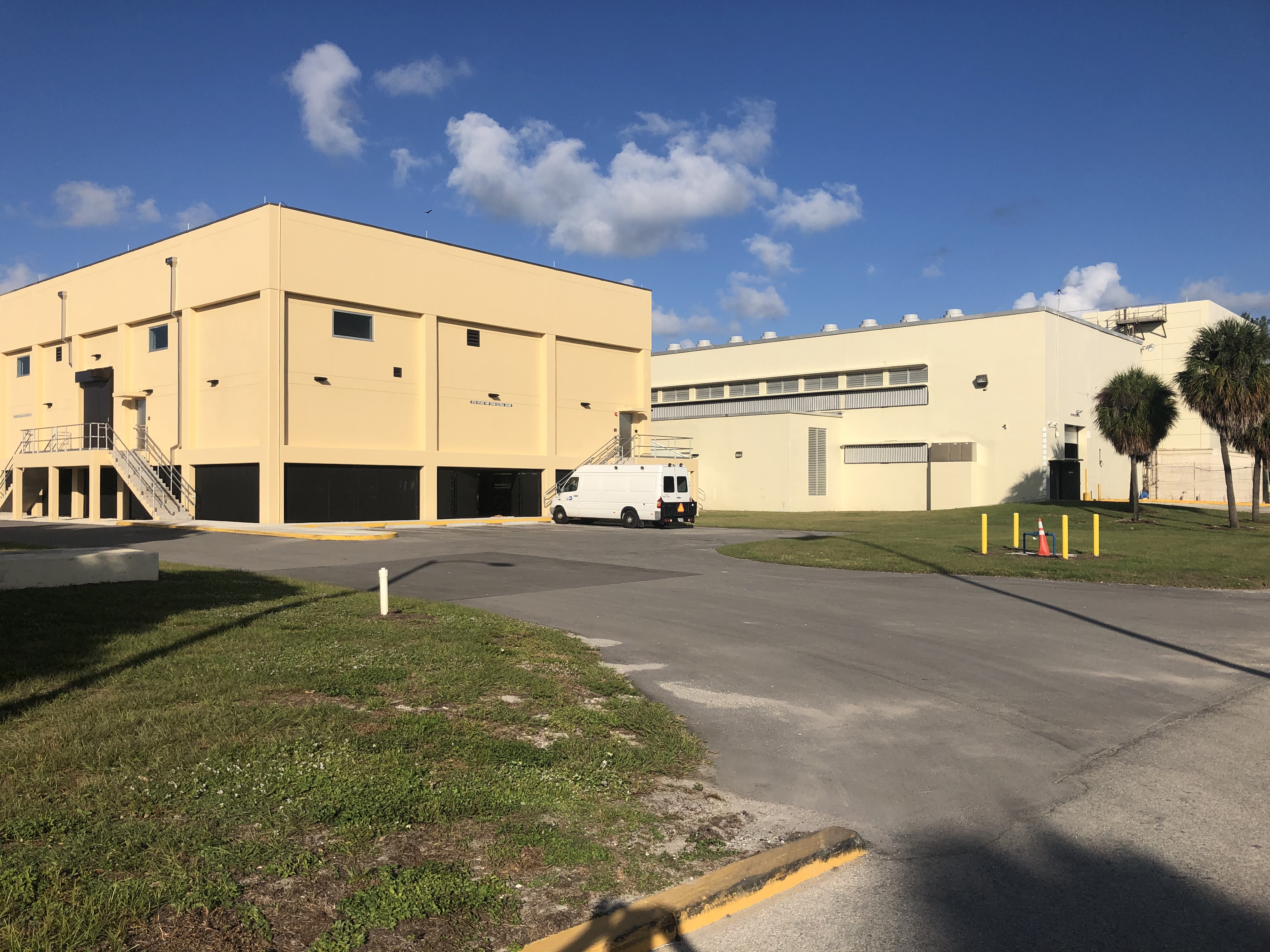
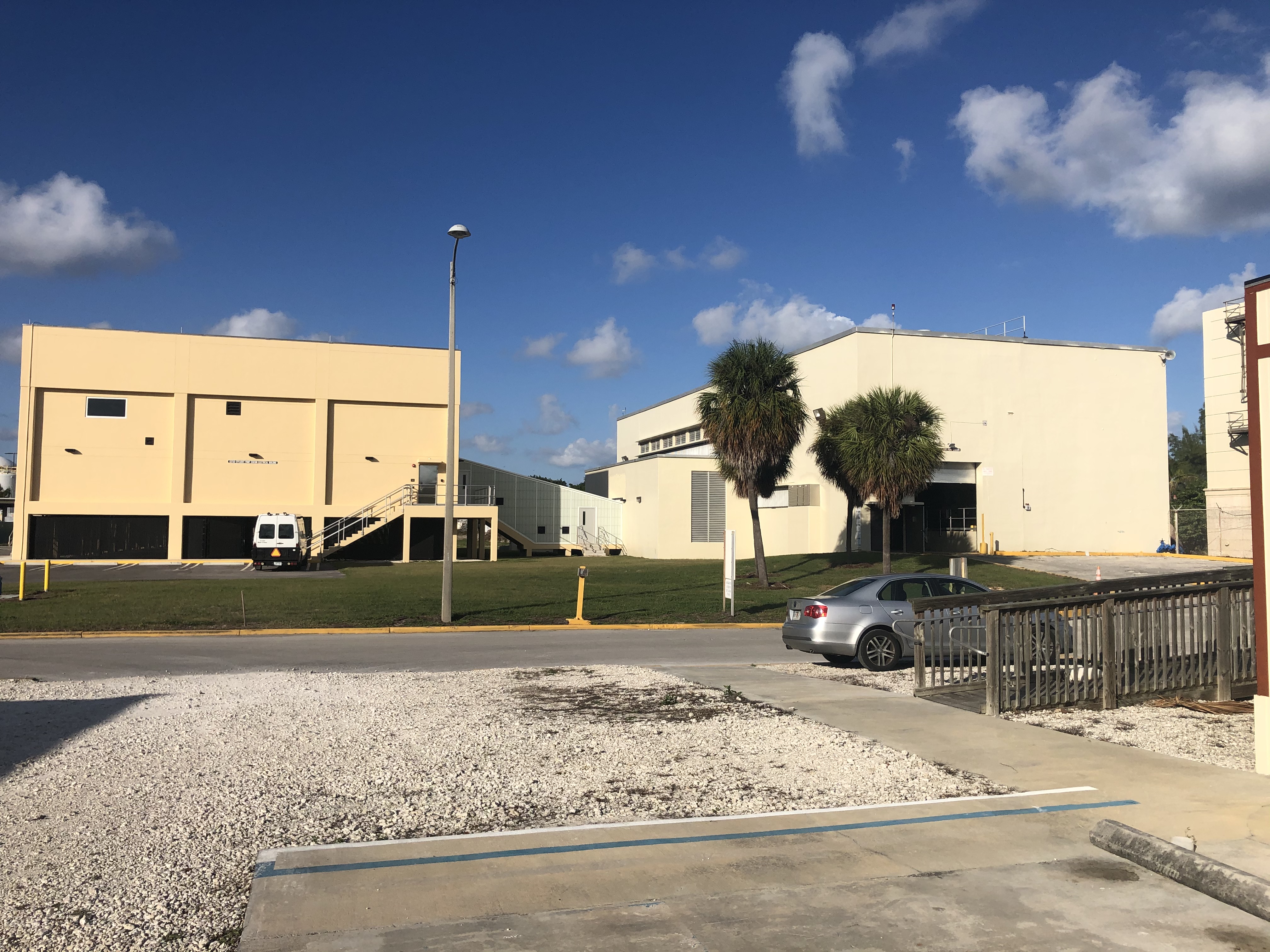
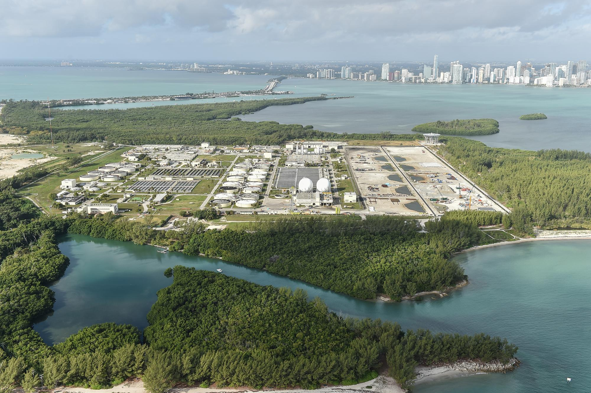
Miami-Dade County uses these unified sea level rise projections to prioritize vulnerable facilities; as a result, the City decided to elevate the Central District Wastewater Treatment Plant facilities on Virginia Key to 21 feet (Coffman & Arik 2020). The amount of elevation was determined by the County by using the following formula for retrofitting of existing wastewater treatment plant facility assets: FEMA BFE + 3-feet sea level rise (2011 SEFRCC unified projections) + 2-feet freeboard (ASCE Standard 24‐05/2010 FBC Category IV) + 48 inches safety factor (NOAA High projection for 50‐year planning horizon) (Miami-Dade County 2021).
![]()
Nature-based solutions to sea level rise often yield multiple benefits to the community and the environment. Co-benefits not only enhance the community, but can also appeal to funders and create more value for the investment.
Nature-based solutions, as opposed to traditional grey infrastructure solutions, use natural features or processes to promote adaptation and resilience. Nature-based solutions also tend to generate multiple benefits in addition to flood protection, such as ecological restoration, increased greenspace, and reduced urban heat islands, among others. Any project that creates multiple benefits for the community and the utility (including nature-based and traditional engineered solutions) often appeals to funders. When seeking funding, utilities should consider highlighting the additional benefits which can sometimes allow for layering of funding sources.
Cecchetti et al. (2020) evaluated the use of a horizontal levee to reduce flooding from storm surge, provide space for wetland migration as sea levels rise, and remove contaminants from treated water discharged into the ocean. The authors designed an experimental horizontal levee in San Lorenzo, California, to treat secondary effluent from the Oro Loma Sanitary District's wastewater treatment plant and evaluate performance over 2 years to identify levee operating conditions that may be suitable in light of sea level rise. The results indicated that horizontal levees can achieve multiple benefits from increased coastal resilience to sea level rise to significant removal of wastewater-derived contaminants (e.g., nutrients, pharmaceuticals, F+ coliphage) and may support potable water reuse.
Kirshen et al. (2020) evaluated the technological and economic feasibility of a range of adaptation options to address coastal flooding in Boston, Massachusetts including physical harbor-wide barriers, elevated infrastructure along the shoreline, and nature-based solutions. The study found that the harbor barriers were associated with several limitations, while elevating infrastructure and using nature-based options yielded multiple benefits (e.g., flood protection, minimal environmental impact, more flexibility) more quickly and for less money.
![]()
Look for innovative engineered ways to "make room for water."
In places where it is difficult to completely prevent flooding, accepting that flooding will occur and finding innovative ways to accommodate extra water can reduce flooding risks and resulting damage. Historically, at least in the last 100 years, humans have tried to prevent flooding by engineering hard structures to keep water out (e.g., levees or seawalls implemented by USACE). In recent years, especially in places vulnerable to sea level rise, there has been a paradigm shift, and communities are now finding ways to live with water and turning to approaches that let water in. The combination of urban design strategies (e.g., parks designed to temporarily take on flood waters), nature-based solutions, and gray infrastructure can be used to create space for flood waters.
![]()
Retrofit existing critical infrastructure to accommodate rising water levels.
While often challenging and costly, retrofitting existing infrastructure is an important way to build resilience into vulnerable assets and systems. Retrofitting can prevent service interruptions during flood events and should be prioritized based on the flood risk and the importance of the asset (e.g., consider the criticality, replacement cost, population served). Retrofits may include raising electrical equipment out of the flood zone, moving an asset to a less vulnerable location, floodproofing buildings and equipment, enlarging parts of the stormwater system, and adding pumps to convey flood waters or add redundancy.
The City of Portsmouth, New Hampshire, Public Work Department is creating ways to accommodate storm surge-induced flooding and rising sea levels. The city contains ~100 miles of sewer pipes and ~65 miles of storm drain pipes in its separate sewer area but sections of the city are still served by a combined sewer. Like many older cities in the U.S., parts of Portsmouth's storm and sewer system are undersized and reaching the end of their useful lifespans—some pipes are nearly 100 years old. When they experience storm surge or extreme weather events with heavy precipitation in combination with high tides, it is hard for their stormwater system to drain which can lead to surface flooding. Additionally, their combined sewer system can cause basement backups and overflow into nearby water bodies during these events. The City has worked for decades to address these issues. They successfully reduced flooding, combined sewer overflow events, and sewer backups into basements by (1) separating parts of their combined sewer system, (2) building additional upstream outfalls to reduce the amount of water backing up further down in the system, and (3) by rerouting some storm pipes to locations where they can better discharge. The City has real-time monitoring data from their sewer overflow systems that show improvement in decreasing flooding impacts during storm and storm surge events.19
The City of Anacortes, Washington, redesigned their water treatment plant to address flooding and saltwater intrusion. The redesign and construction included raising critical electrical equipment out of the (current) 100-year flood elevation level; installing ring dikes and pumps; utilizing water-proofing techniques below the ring dike elevation (40 feet); and developing a more effective sediment removal process (EPA 2022; SC2 2015).
![]()
While adaptive management approaches are necessary for dealing with the uncertainty associated with climate change, longstanding planning principles and tools (e.g., land use planning or marine spatial planning) can still be useful (or modified) to better understand risk and identify adaptation solutions.
Traditional planning principles are a good place to start and can serve you well when developing sea level rise adaptation strategies; however, they do not typically allow for much flexibility in the long-term planning process. Finding ways to reimagine longstanding planning principles and standardize an adaptation approach that works for your utility can be beneficial for addressing the deep uncertainty associated with sea level rise. Beyond traditional planning principles, new adaptive management strategies have been developed to manage climate uncertainty and build in flexibility, such as the Dynamic Adaptive Policy Pathways (DAPP) approach (Haasnoot et al. 2013). DAPP is an adaptive management strategy that allows planners to develop different future pathways that can be switched between as conditions change or certain thresholds are met or exceeded.
The City of Norfolk, Virginia, has developed a plan that prioritizes zones within the city for adaptation action based on future and present threats from climate change as well as economic potential and number of assets in an area. Four types of zones were created and four different approaches were developed to address sea level rise and flooding in the city, one for each zone. This planning and prioritization of actions has allowed the City to customize implementation efforts and information outreach based on each zone’s specific characteristics and needs. In addition, due to risk analyses and “priority zone” planning efforts, the City has been able to connect adaptation planning with future plans for infrastructure development within the city and infrastructure hardening projects with USACE. These efforts can help the City mitigate future technical barriers in planning by providing clear options and priorities. Adaptation actions considered or implemented by the City in the priority zones include expanding flood protection systems and raising the sea wall, developing new zoning ordinances and resilience requirements, investing in transportation infrastructure, and community outreach.20
National assessments in New Zealand have identified stormwater and wastewater infrastructure as more exposed to sea level rise than any other kind of infrastructure (Paulik et al. 2020). It is anticipated that the slow incremental rise of the sea, as opposed to flooding caused by extreme episodic events, will have the largest detrimental impact on drainage systems. Sea level rise makes it harder for these systems to discharge and subsurface drainage pipes could be infiltrated by groundwater as it ascends with sea level rise. In Hutt City, an area near Wellington, New Zealand, Dynamic Adaptation Policy Pathways (DAPP) were used to explore whether the mostly gravity-fed stormwater and wastewater networks can be adapted over time to retain Levels of Service, or whether full or partial retreat is the only viable option in the future (Kool et al. 2020). Through interactive workshops, stakeholders identified critical thresholds (e.g., 0.3 m of sea level rise) by stress testing the drainage system and determining when it would no longer be able to provide the necessary level of service (quantitative) or lead to unacceptable conditions (qualitative). Different thresholds were developed depending on the asset type (e.g., subsurface pipe or pumping station). They then developed aligned location-specific adaptation actions to avoid reaching that threshold or planned retreat strategies that would be initiated if reaching the threshold was unavoidable. Strategies to adapt generally involved increasing surface detention systems to keep water out of the drainage system in the first place (e.g., water-sensitive urban design). Comprehensive planned retreat strategies include several pathways for action and consider the community's coping capacity. Different phases of retreat and approaches for implementation (e.g., community-led versus service removal) were identified with an assessment of pathway conflicts and synergies. Signals or triggers using observations and monitoring are a key part of understanding when a threshold is approaching. The lead time for implementing an adaptation strategy or retreat strategy must also be considered as pathways are developed. More on adaptation pathways can be found in Appendix C of this guide.
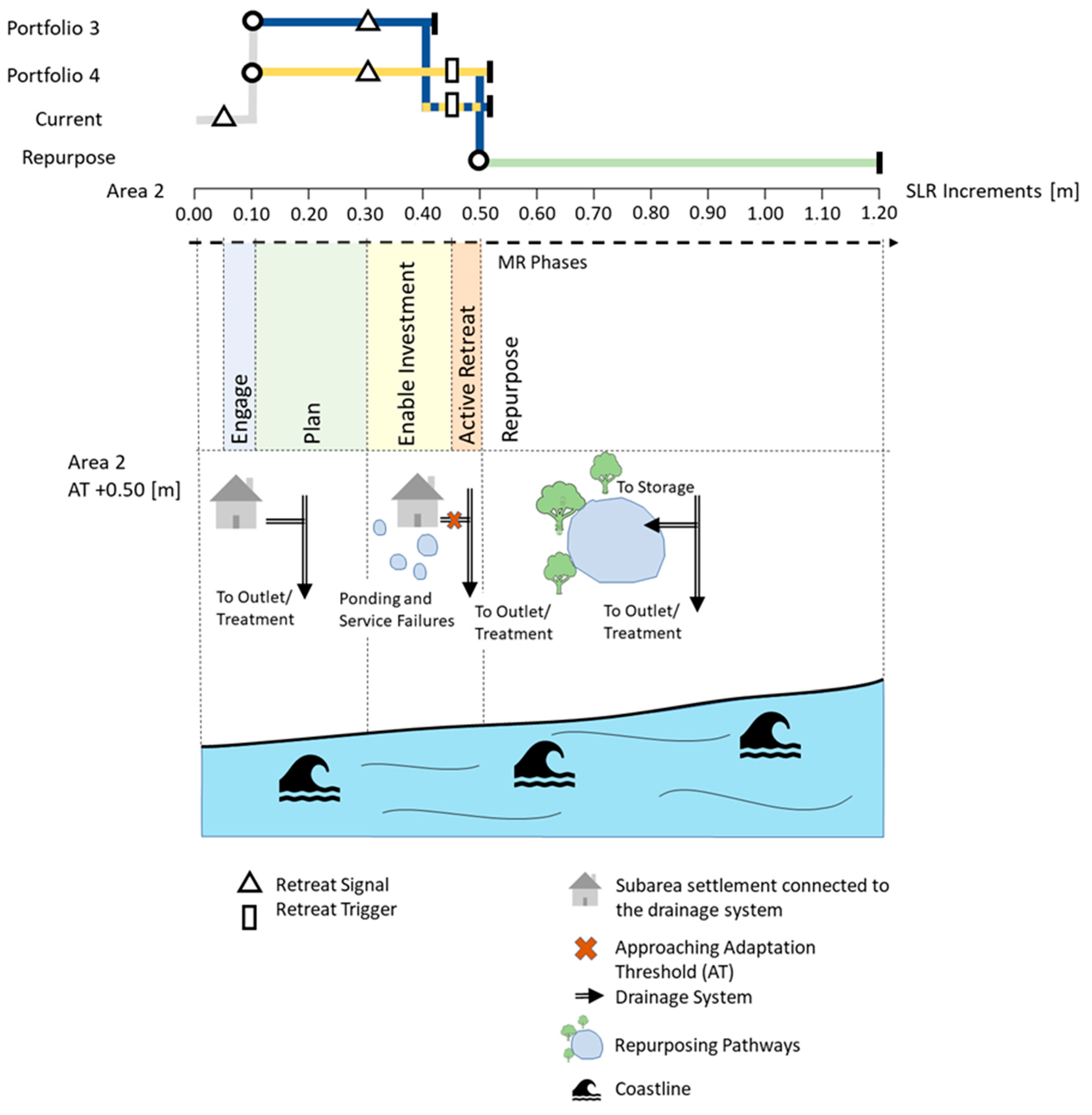
Schematic DAPP. MR= managed retreat, AT= adaptation threshold, SLR= sea level rise
Credit: Kool R, Lawrence J, Drews M, Bell R. 2020. "Preparing for Sea-Level Rise through Adaptive Managed Retreat of a New Zealand Stormwater and Wastewater Network" Infrastructures 5, no. 11: 92.
![]()
Develop standards and tools to help with decision-making and alternatives evaluation.
Invest time into developing standardized tools that can guide adaptation decision-making and prioritize strategies that will best serve your utility. Implementing a standardized and transparent approach for future planning decisions allows for utilities to identify and weight top criteria for project consideration that may be unique to their geographic area or governance structure.
Miami-Dade County Water and Sewer Department (MDWSD) developed a decision support matrix to prioritize adaptation options to address the impacts of sea level rise. The matrix allows MDWSD to compare the costs, risks, and operational impacts that alternative adaptation strategies will have on specific assets and to make climate-informed design and investment decisions. This process allows for flexibility in planning future actions and pairs with MDWSD's Design Guidebooks that were developed for wastewater treatment plants and pump stations. The combination of these two tools will help design engineers to plan for and understand impacts, the timing of events, and the necessary elevation of assets based on future sea level rise projections.21
Lack of "actionable" information and tools that can be used directly in assessments and studies addressing climate change can often be a barrier for those trying to take adaptation action. The Philadelphia Water Department (PWD) has addressed this challenge by developing several products and tools to better understand and address sea level rise adaptation for water utilities. For example, PWD has produced estimated future tidal data and storm surge elevations for use in project planning and design; a customized Geographic Information System (GIS) tool that estimates and illustrates the timing and extent of future coastal flooding and enables PWD to screen existing assets for future flood exposure; a Design Flood Elevation for new capital projects that incorporates sea level rise projections and goes above local floodplain regulatory requirements; an Excel-based tool that uses different sea level rise scenarios and provides estimates for the changing probability of flooding through the end of the century for any input elevation; and written guidance on how to apply adaptive management principles to address sea level rise uncertainty.22
![]()
Find creative ways to augment staff capacity.
A water utility can face challenges surrounding the prioritization of tasks and developing new work to address climate change when there already exist many other "fires" to put out, especially if they are driven by regulations. To build more internal capacity for resiliency work, interns and students can be used to share adaptation workload. Furthermore, partnerships with local organizations or academic institutions can set up data, analysis, and general knowledge sharing conduits that may aid the adaptation planning and assessment processes and avoid duplication of efforts.
Cape Fear Public Utility Authority (CFPUA) in Wilmington, North Carolina, developed floodplain maps for their pump stations for 100- and 500-year flood events through a collaboration with the EPA and integrated some of the findings from the resulting report in its CIP. CFPUA also wanted to document where adaptation measures (e.g., elevating platforms) were put in place as well as collect pump station control elevation data. CFPUA acquired all the necessary equipment, but due to lack of staff capacity and interest at the time, CFPUA was unable to obtain monitoring and evaluation data.
To address this challenge, CFPUA has used interns and local partnerships to collect data that aided in the creation of an interactive map displaying flood resilience and CFPUA assets and to develop a source water protection plan and resiliency report.
CFPUA staff working on climate change adaptation emphasize the importance of strengthening and maintaining relationships with CFPUA board members, city and county governments, local universities, and citizen groups These collaborations, as well as buy-in from CFPUA's Environmental Group, sustainability committee, financial director, and other local partners, has not only led to the creation of the source water protection plan and resiliency report but also progress toward adaptation implementation and unified support for adaptation action.
From CFPUA's perspective, finding common ground and engaging local partners can lead to alignment in priorities and marrying of funding that can be a catalyst for building resilience from both an environmental and social perspective.23
![]()
Footnotes
- Goetz B. 2021. December 15. Personal communication [Personal interview].
- Shea P. 2020. August 19. Personal communication [Personal interview].
- Griner D. & Yoder D. 2020. September 15. Personal communication [Personal interview].
- Rockwell J. & Anbessie T. 2020. November 16. Personal communication [WUCA member questionnaire].
- Eckert B., Severt E., Tremblay E. 2021 December 16. Personal communication [Personal interview]